Welcome to the self-guided Amache Driving Tour!
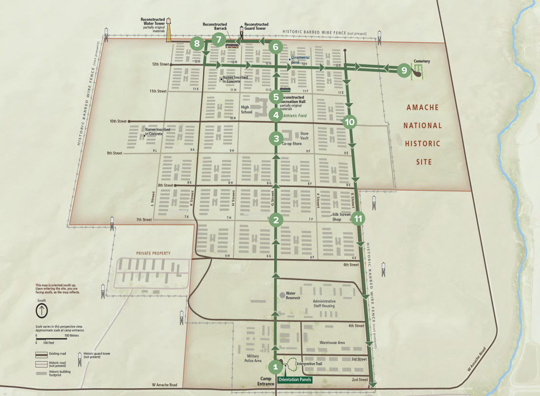
As you explore the site, clicking on the numbered stops on the map below will open audio files that connect you with Amache survivors who share facts, memories, and stories. Please follow the tour route to help preserve the original historic roads and protect this nationally significant site.
The roads you will be driving on are the original roads, and most of the building foundations are still visible today. The driving tour identifies many of the interesting features you can visit if you look carefully, although changes in the landscape may be subtle to visitors not used to navigating this type of terrain. Blocks are named after the street Number and Letter that intersect at the northeast corner of the block. Locations of the reconstructed rec hall, barrack, guard tower and water tower are noted along the southern portion of the site. To prepare for a visit, please be sure to visit the page know before you go or read and download the document suggestions for visitors.
To download the driving tour in its entirety for offline playback, please download the link below. To use, open/unzip the folder and load the files onto your device for playback.
Driving-Tour-2025.zip (43.1 Mb)
Click on the numbered waypoints on the map below to learn more and listen to narrated podcasts.